Snow Observations List
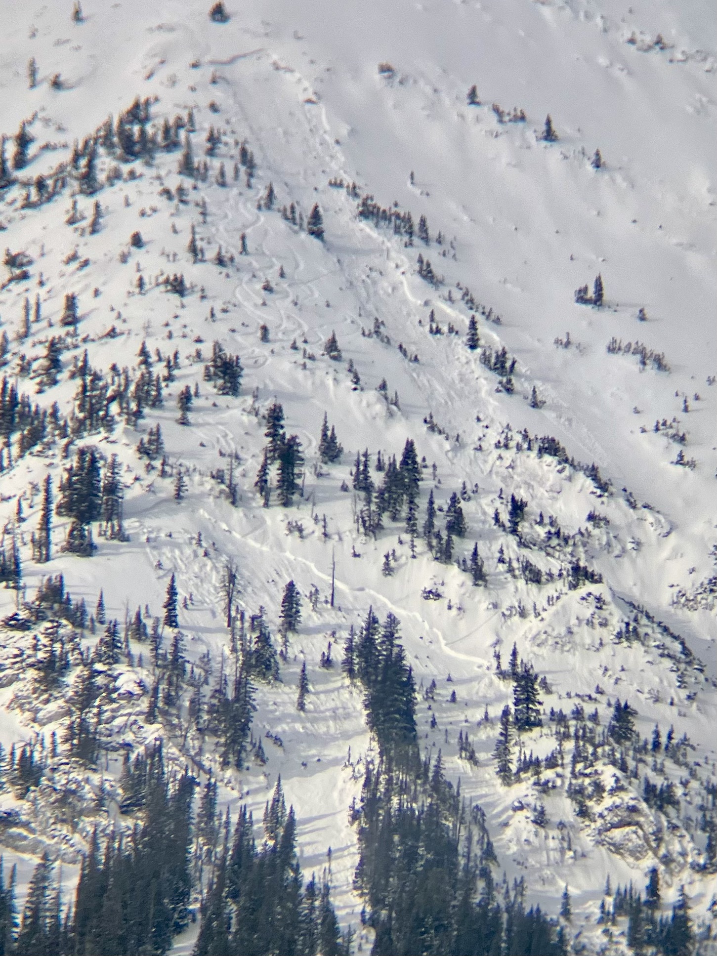
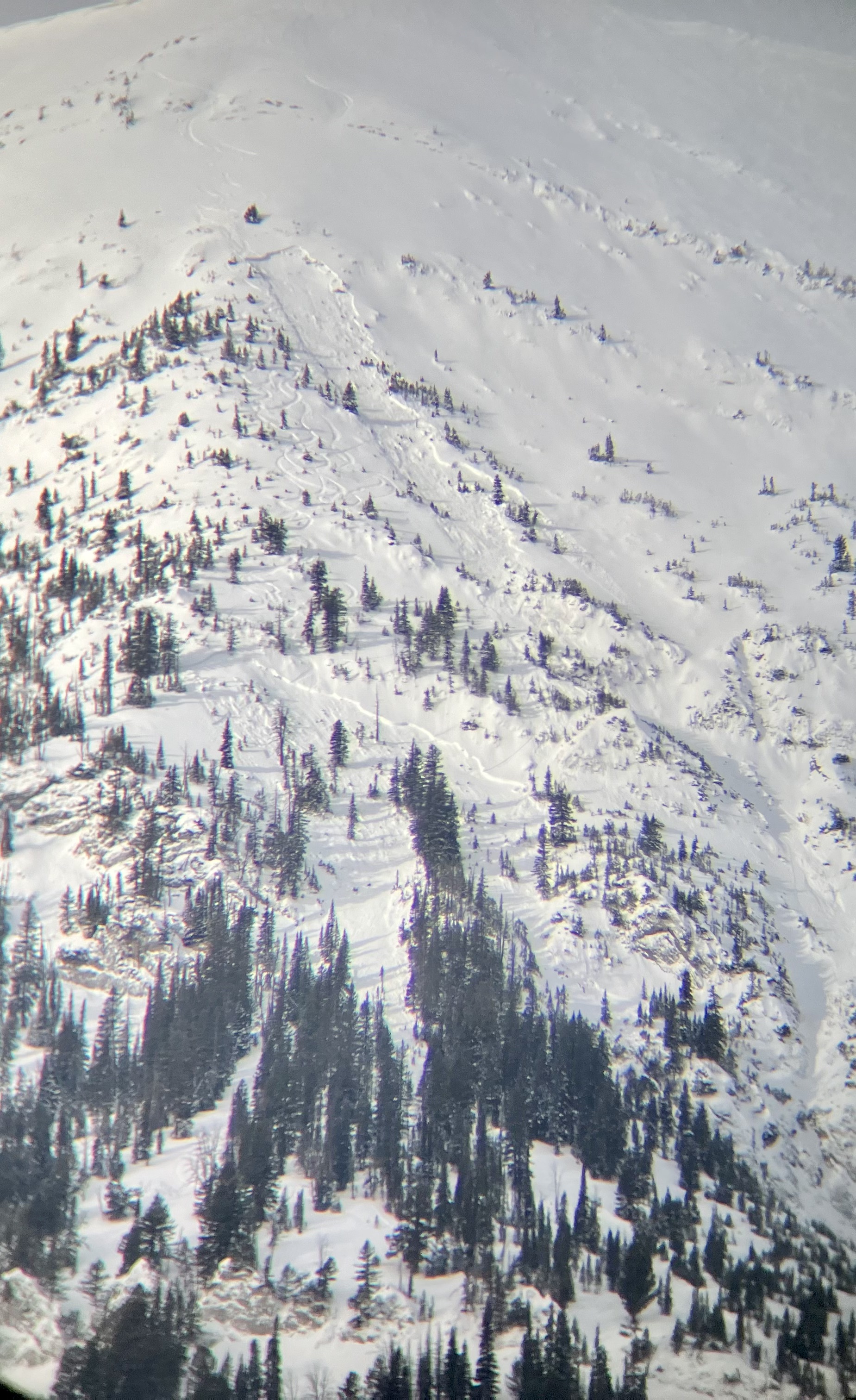
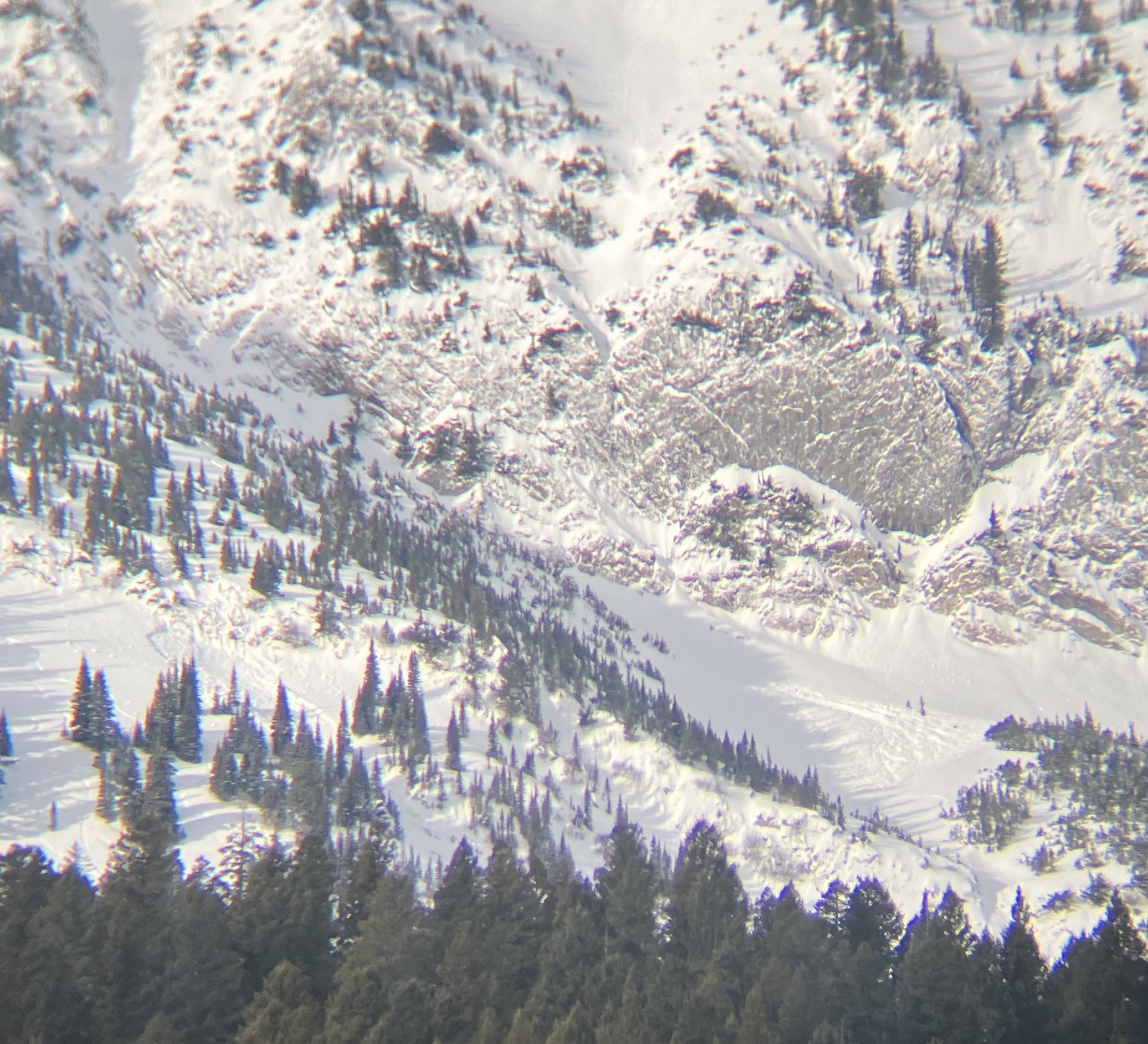
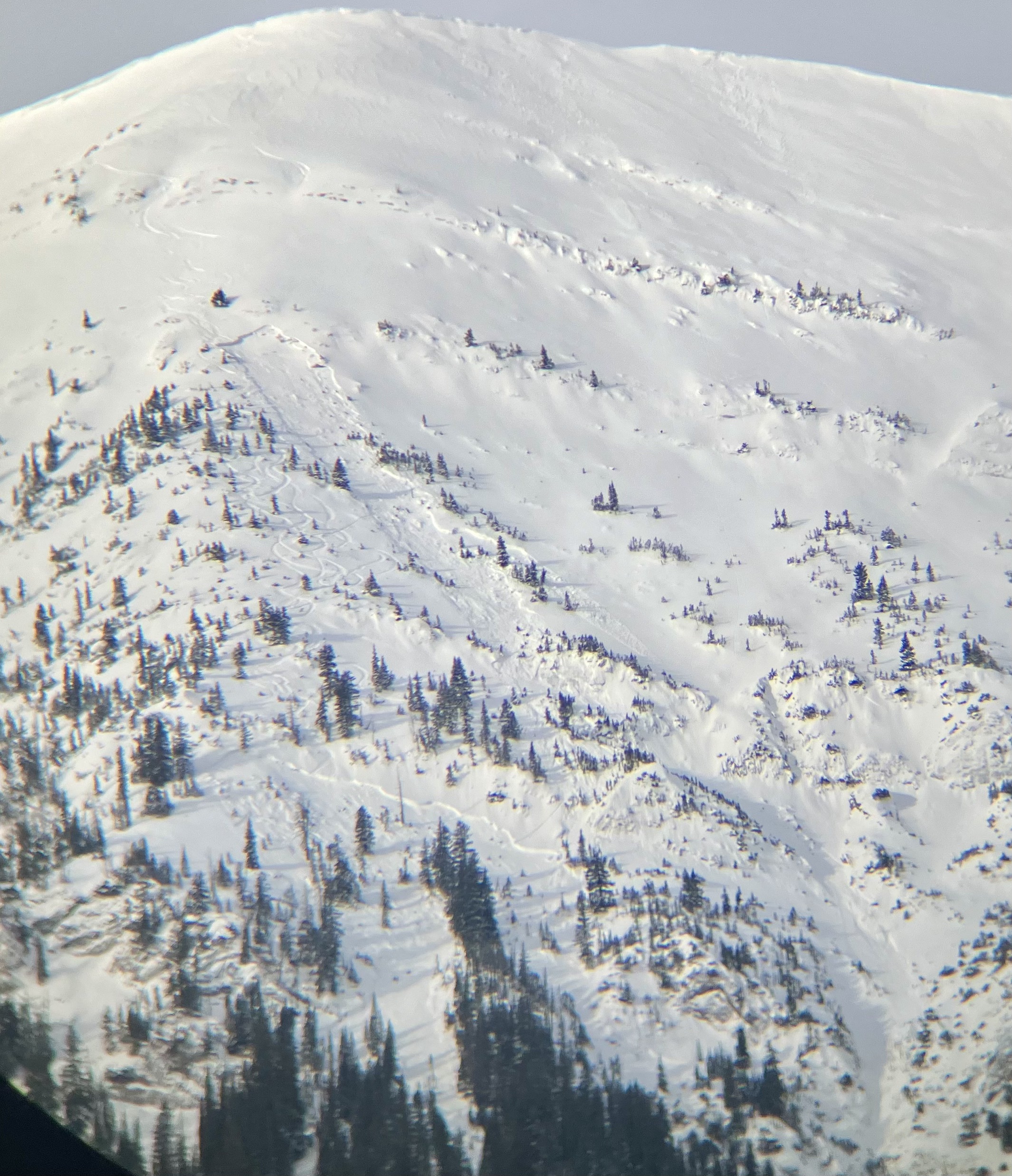
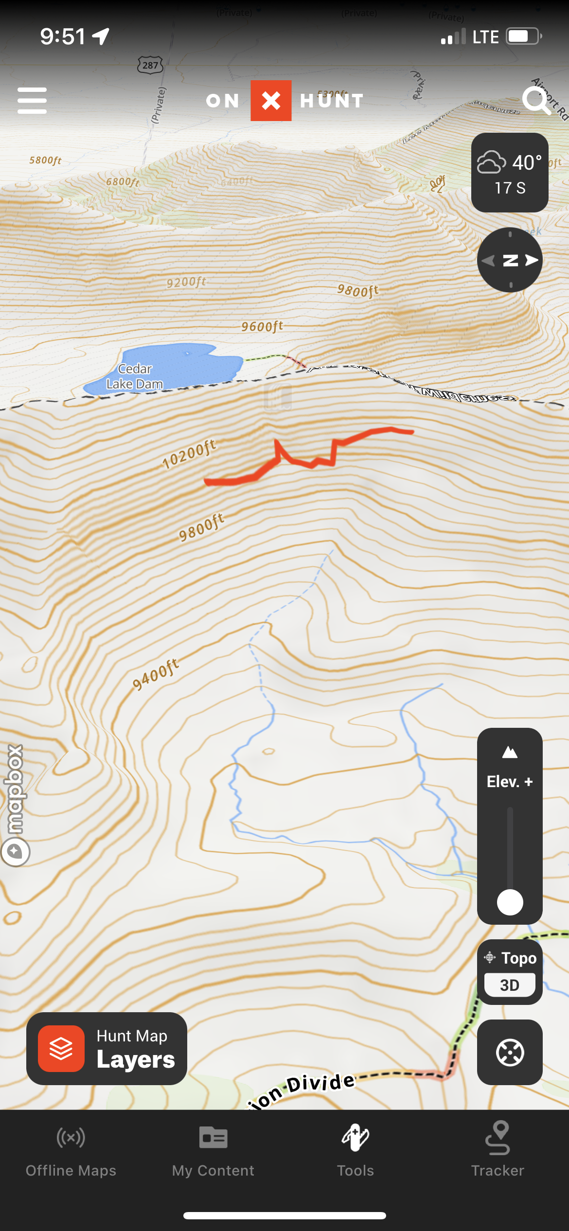
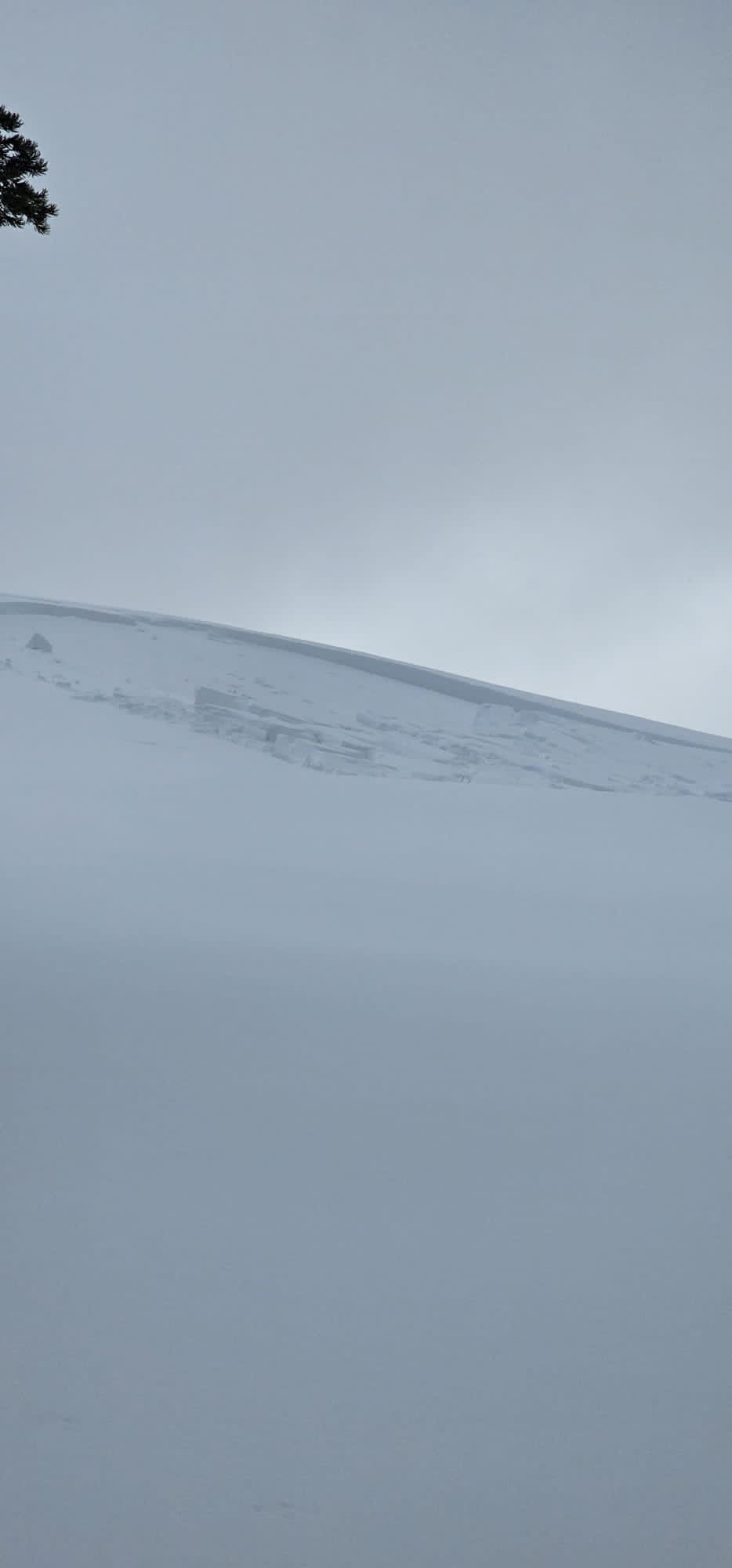
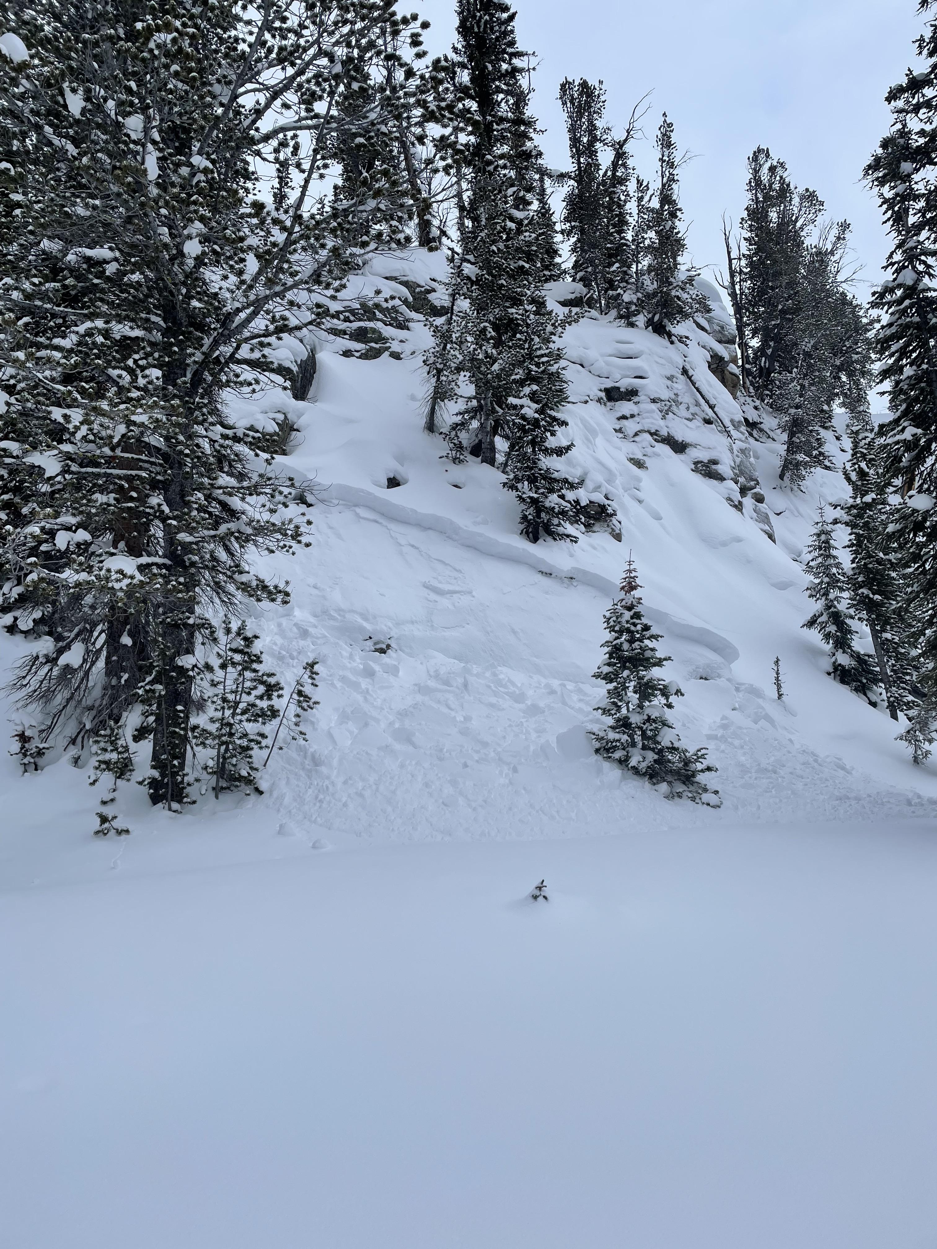
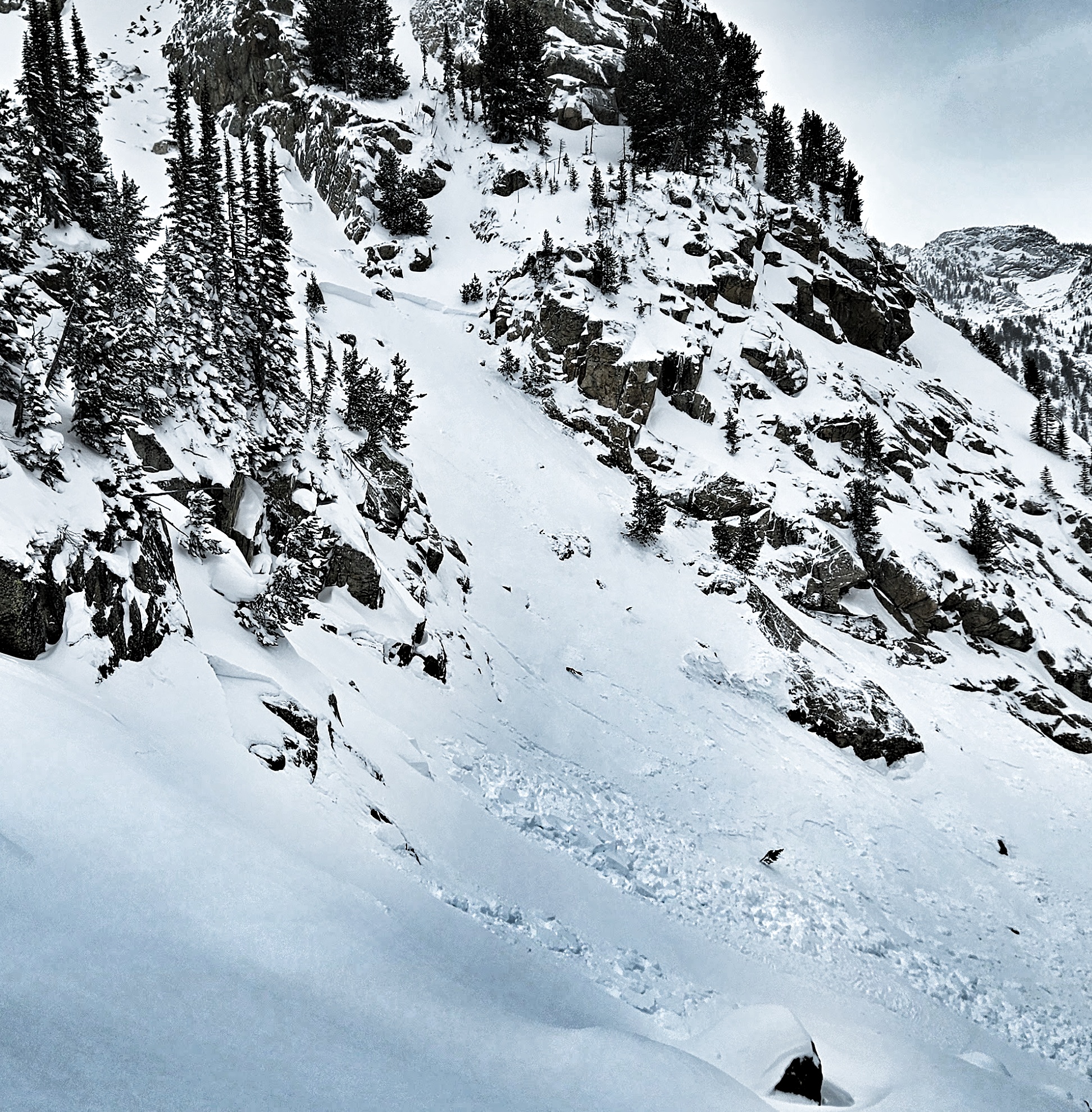
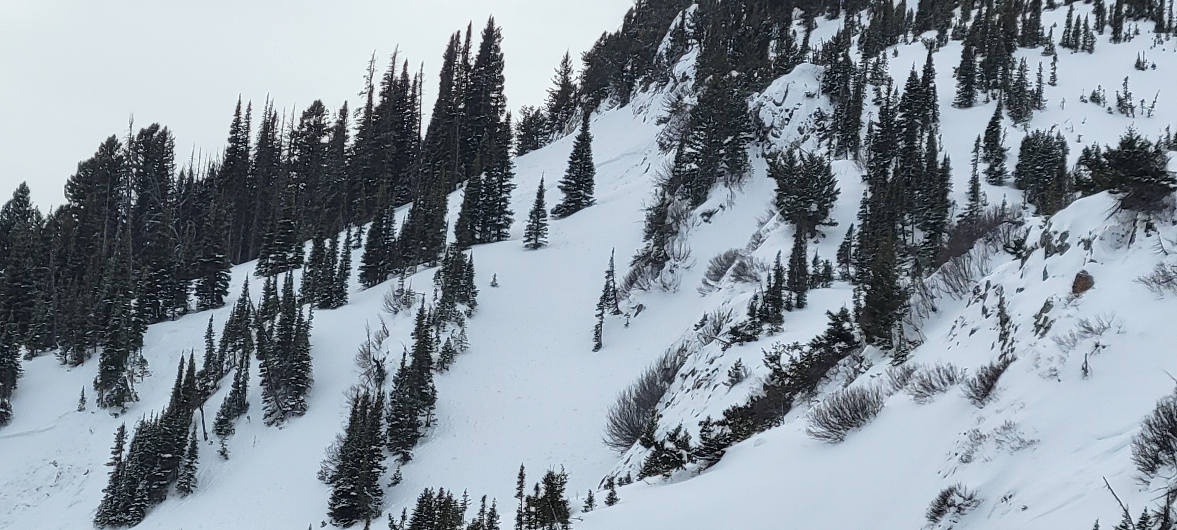
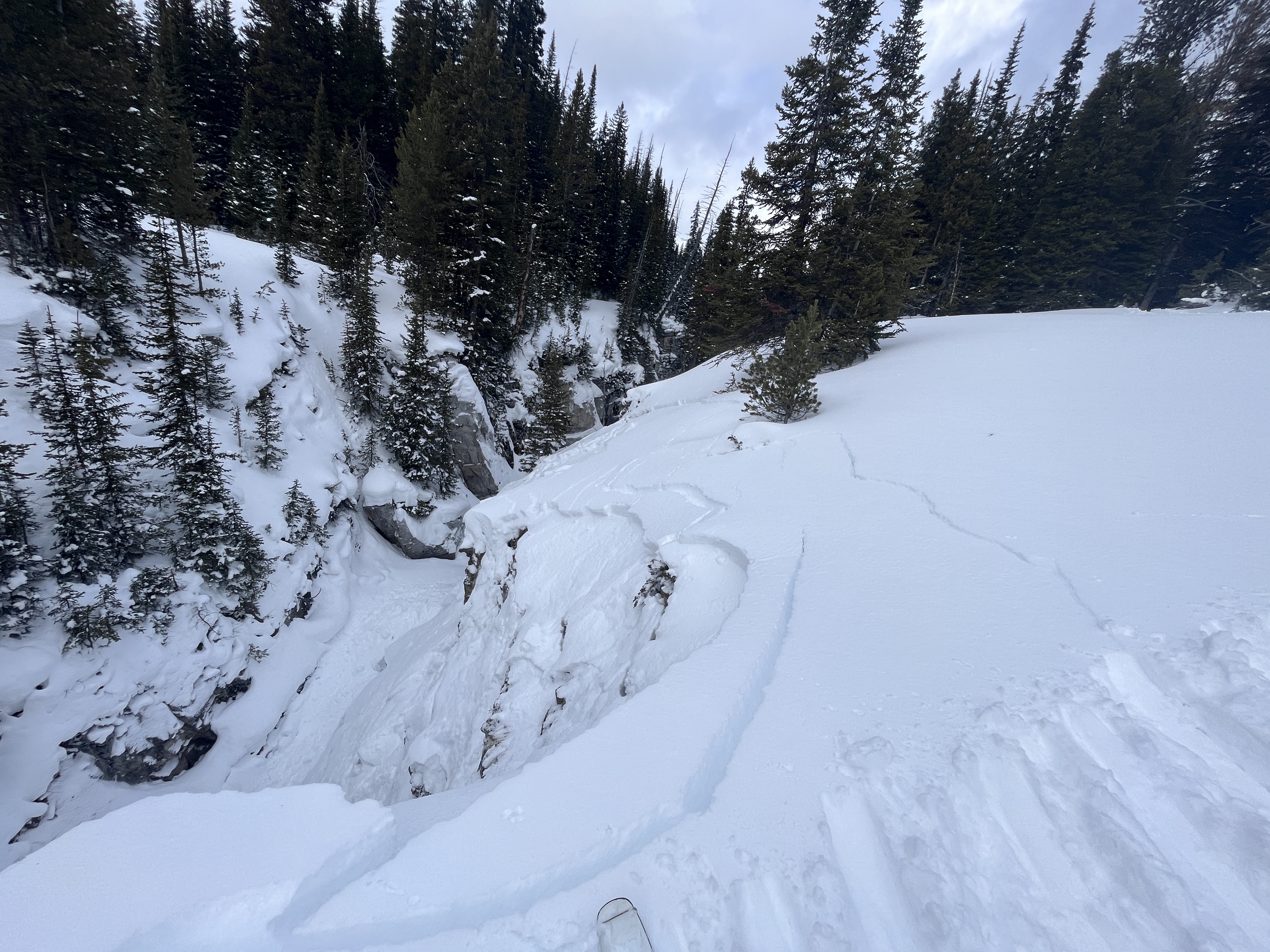
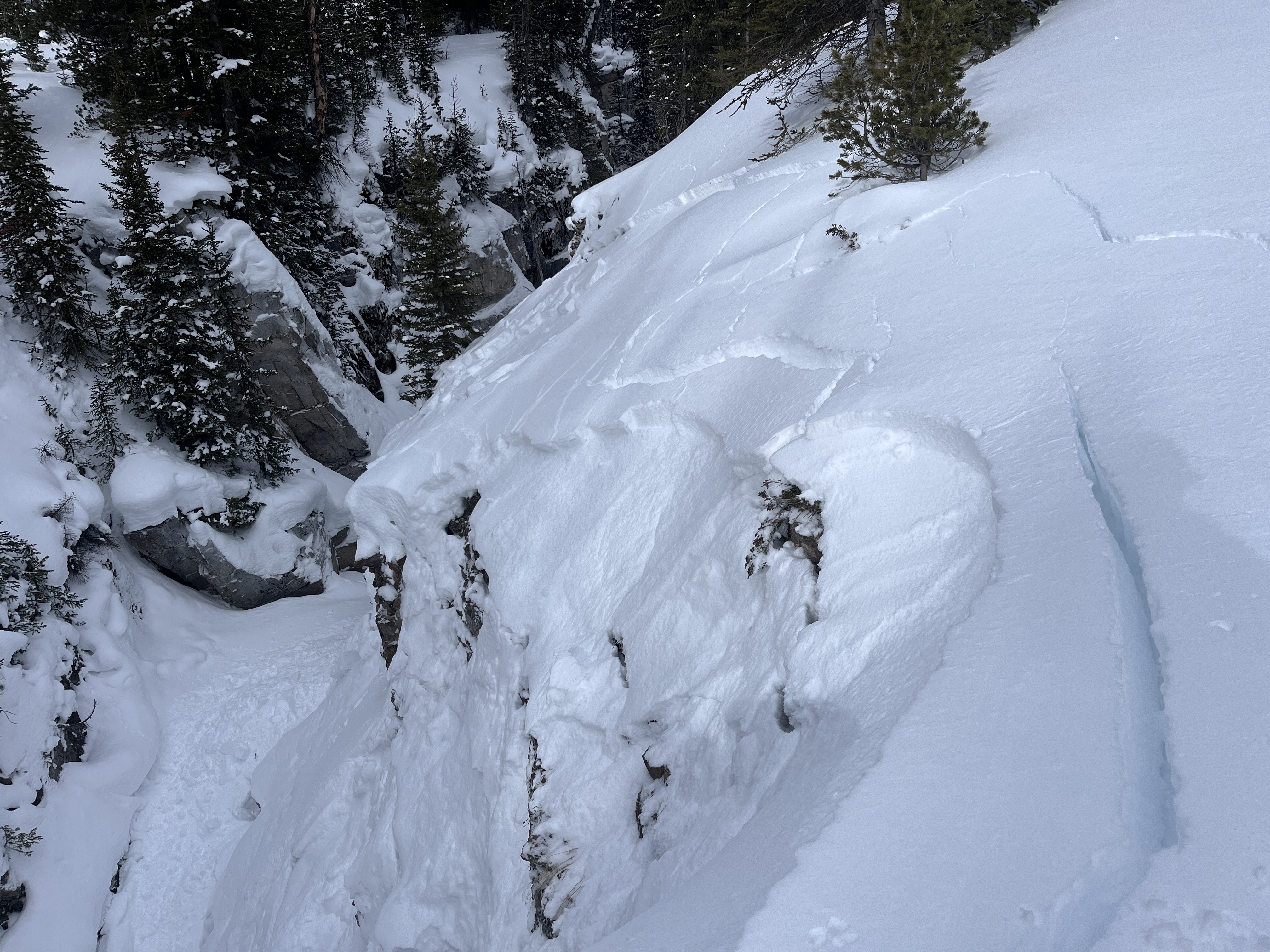
Avalanche triggered by a skier on Saddle Peak on 1/21. No one caught. Appeared 2 feet deep, measured 75-250' wide and 1300' vertical on OnX. Photo: GNFAC
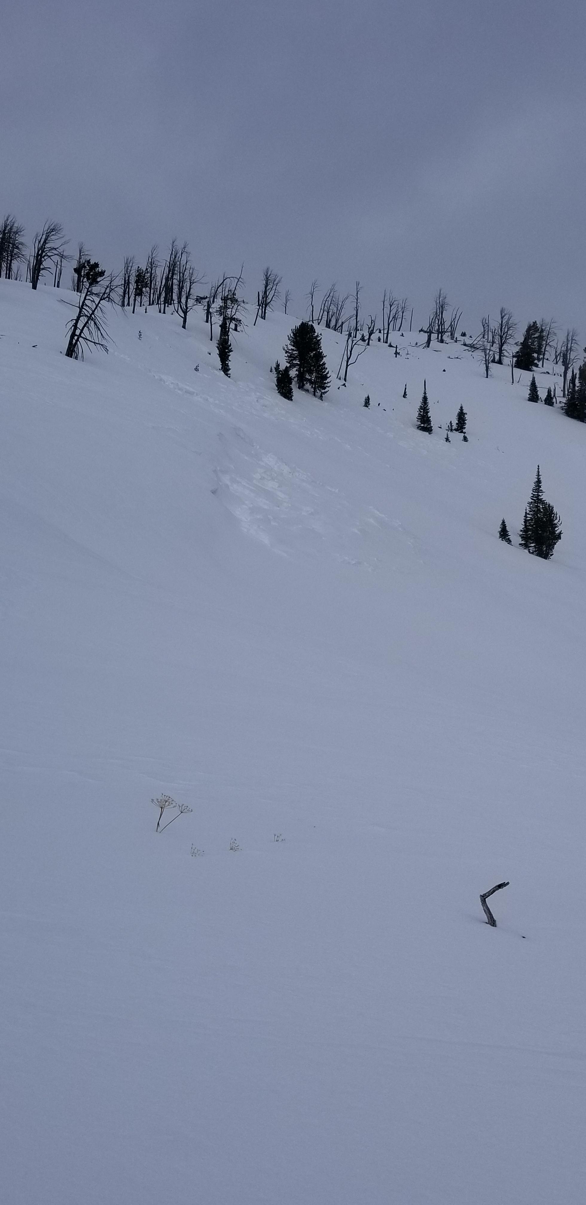
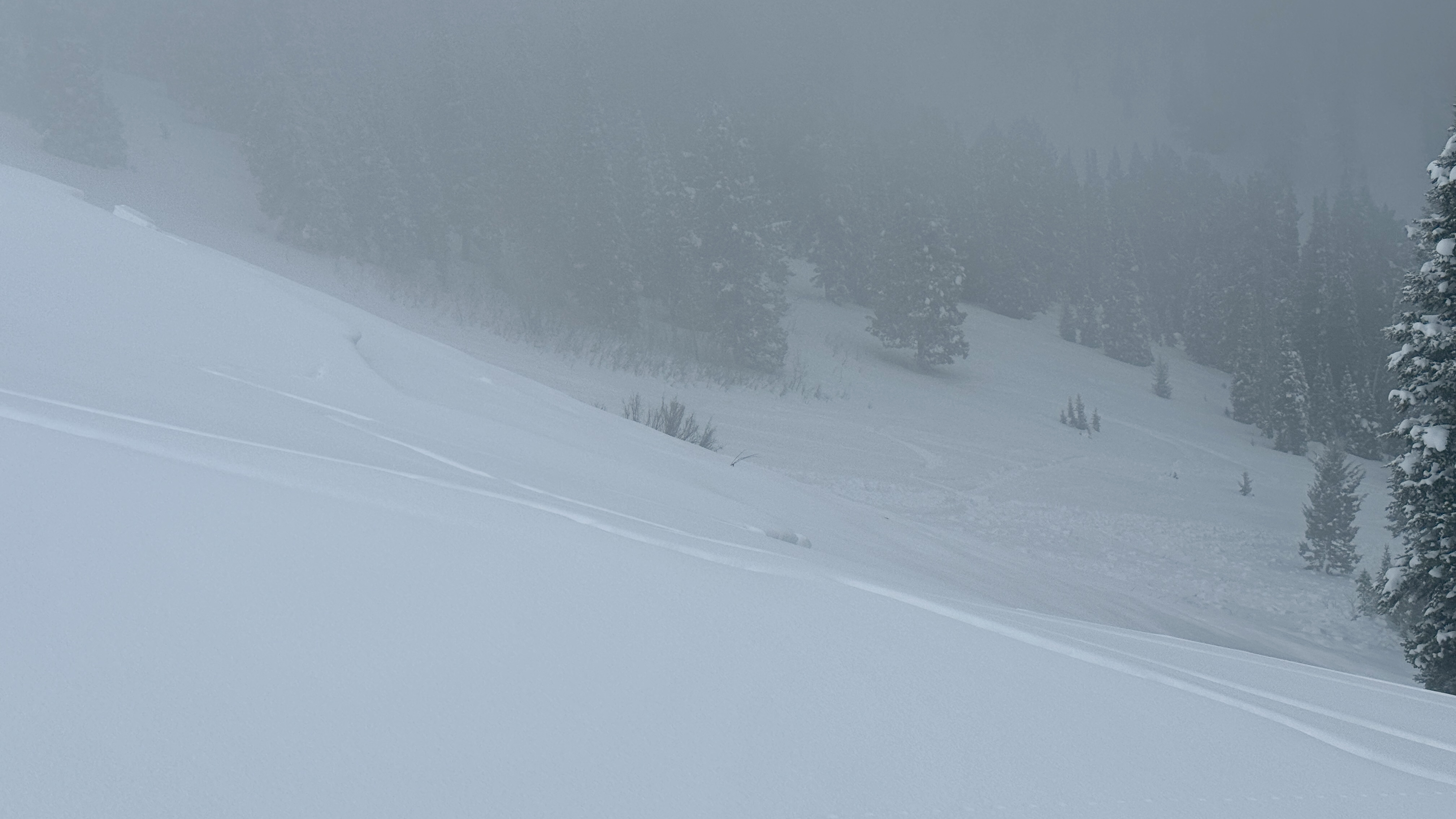
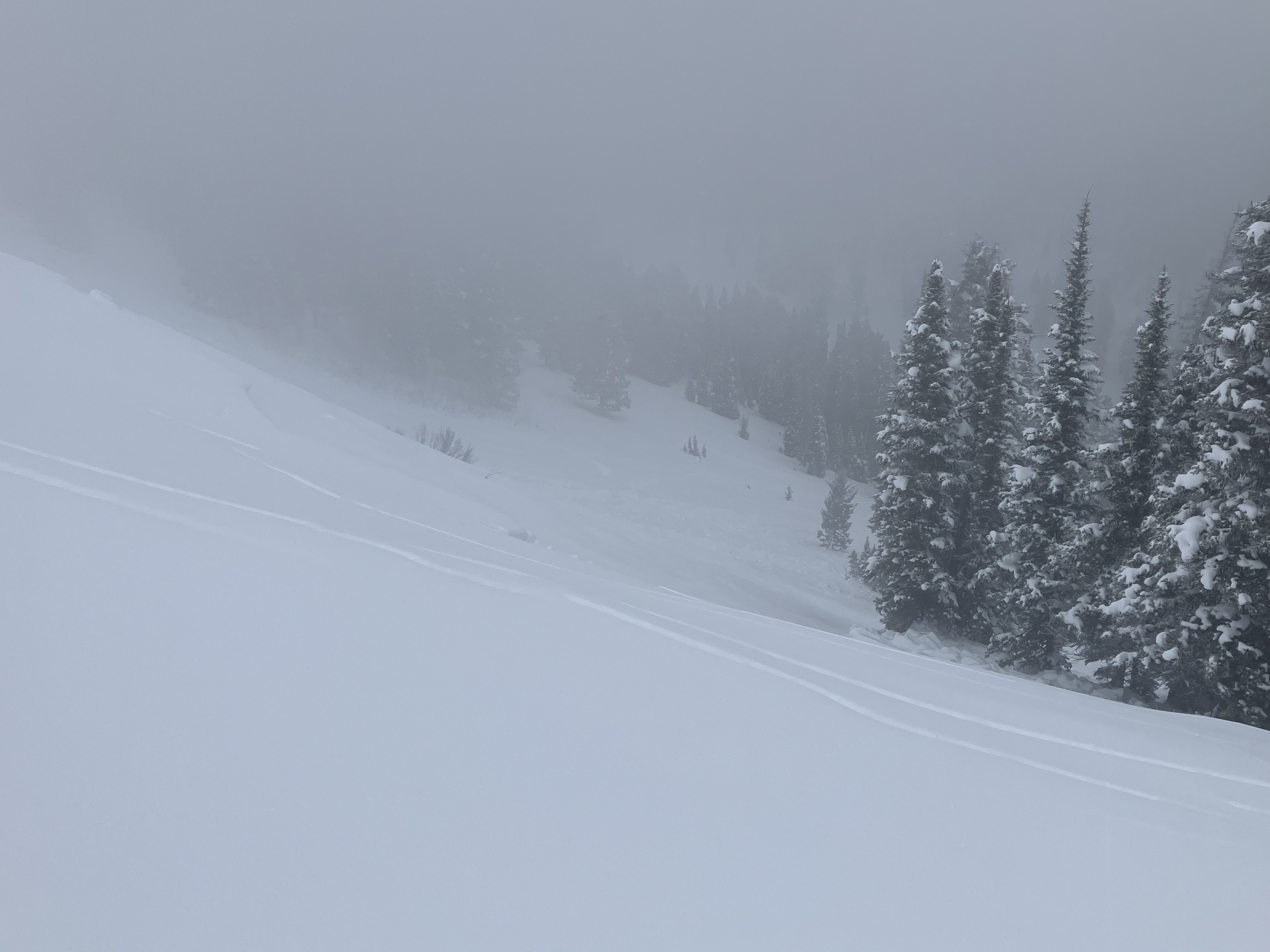
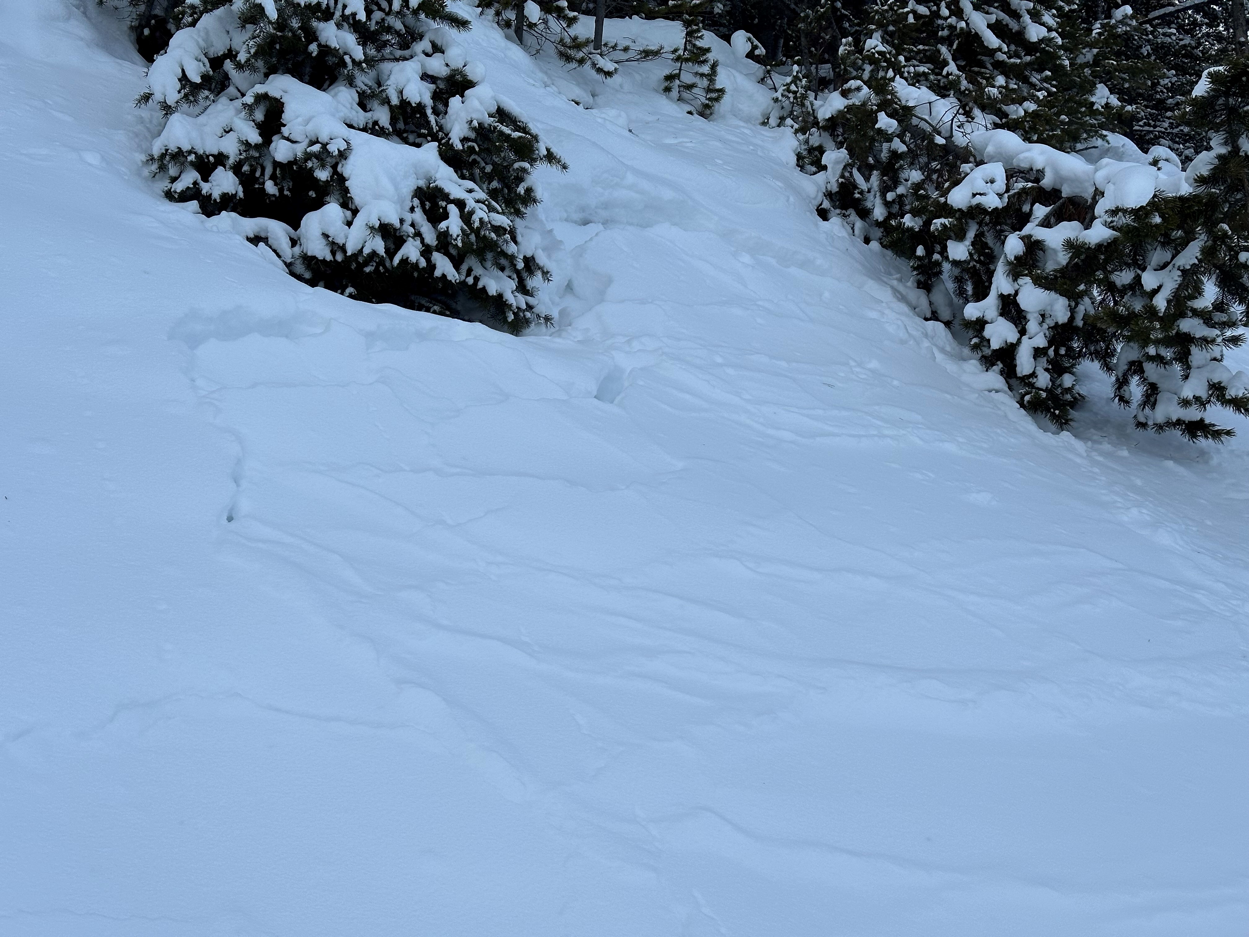
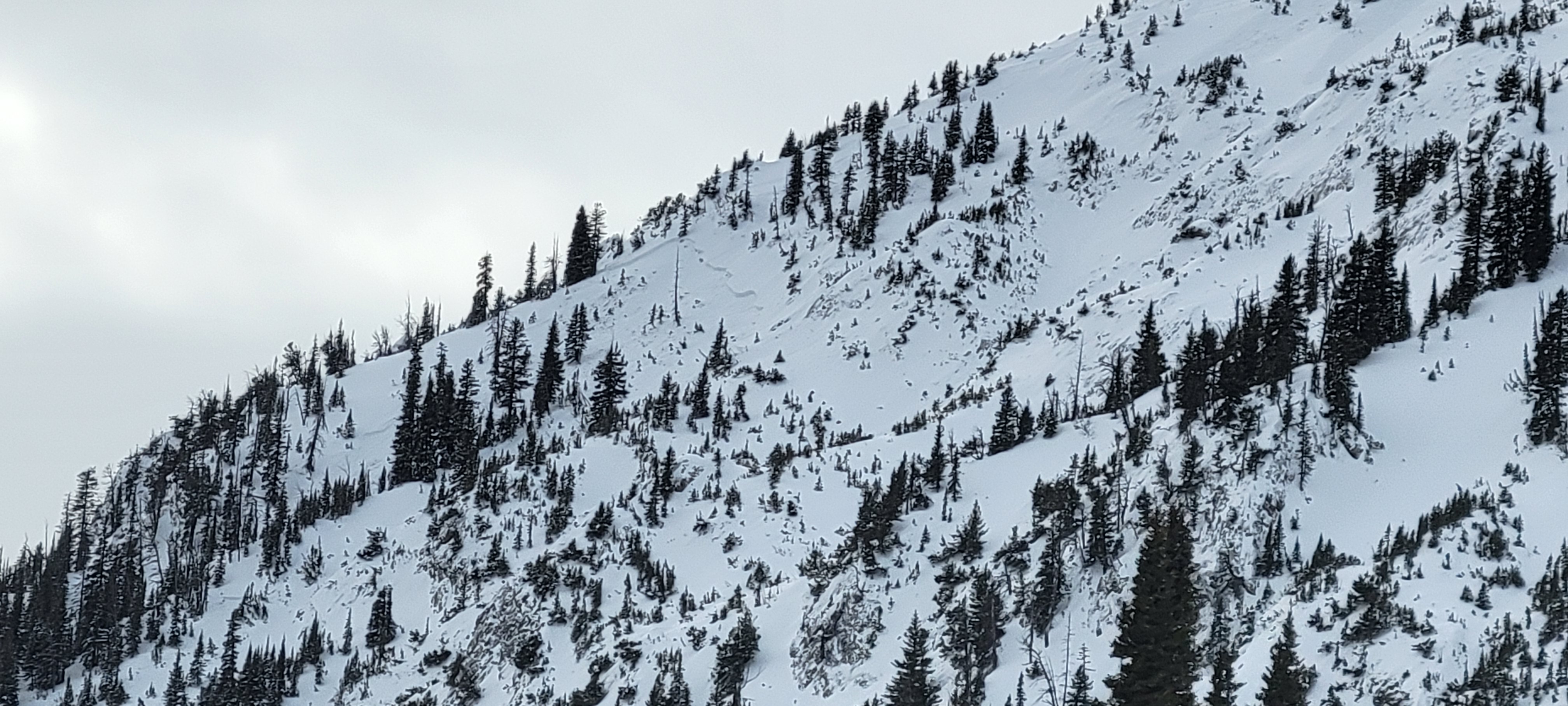
Full Snow Observation ReportStill experiencing whumphing, and cracking along the skin track. Tracks from 24 hrs ago had filled in from wind. Wind today was 3-6 mph at 8900'. HS at 8900', exposed ridge = 30" deep. We saw 2 slides a couple days old? One was either natural or possibly remotely triggered by skiers this weekend (photo attached). SE aspect, about 9000' elev.
Temp was 28° up high, 38° at highway. Ski out from switchbacks down was sticky.
Full Snow Observation Report
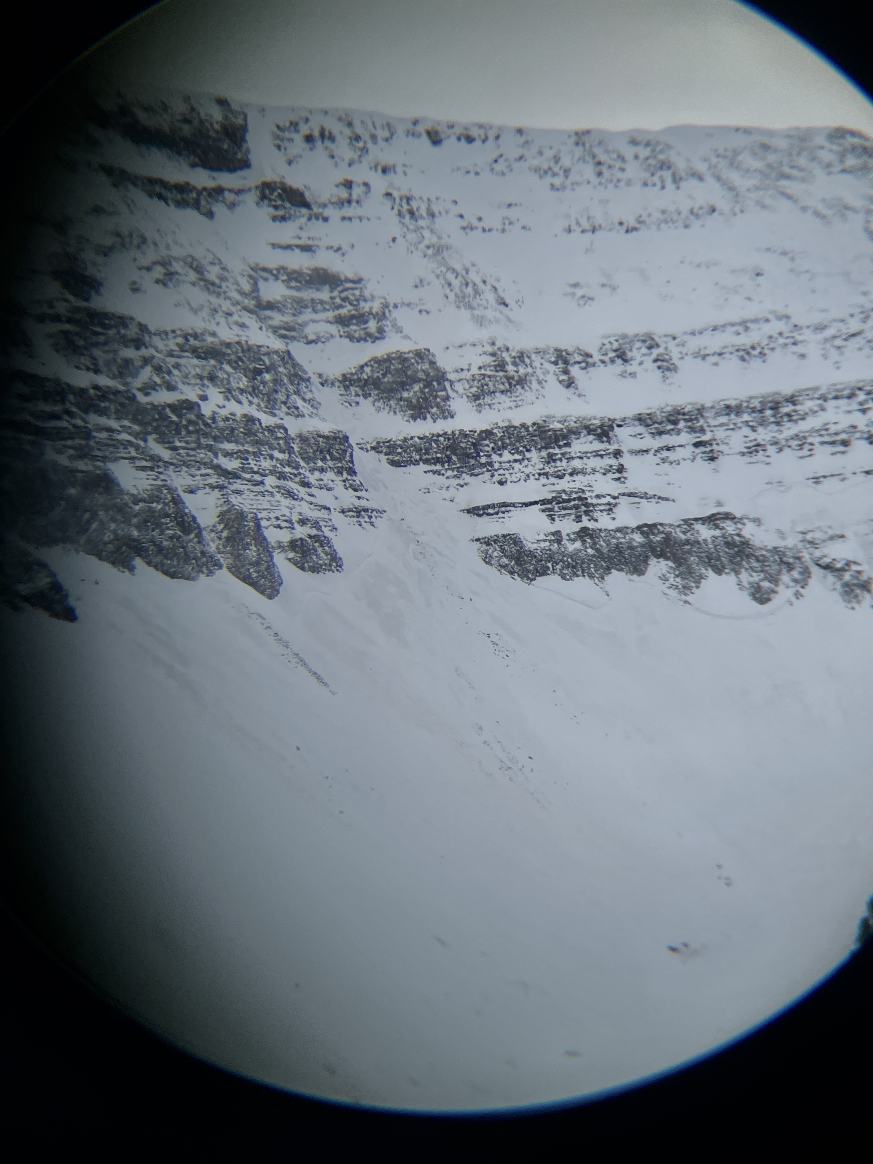
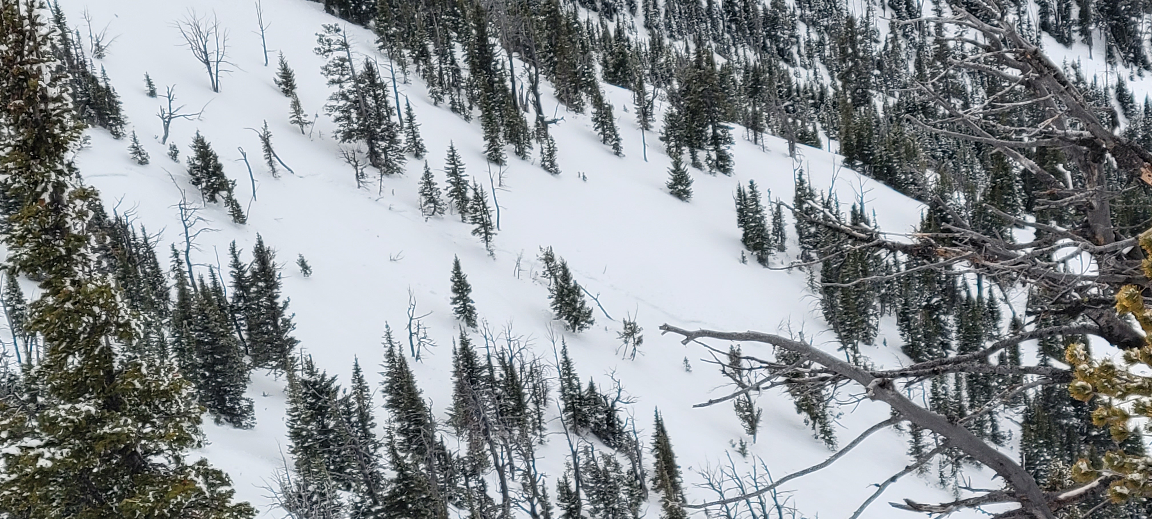
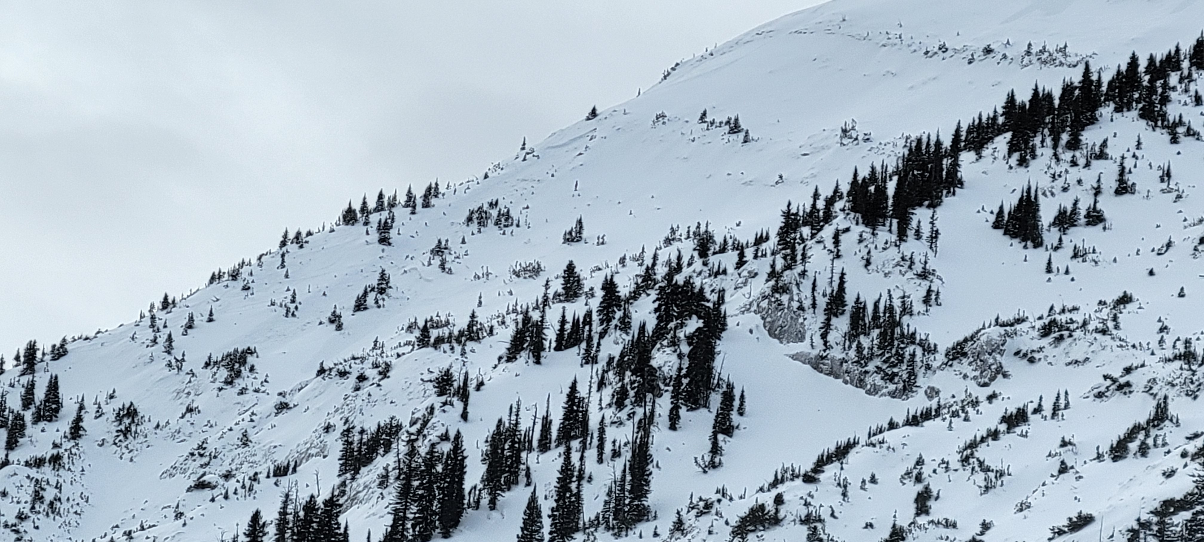
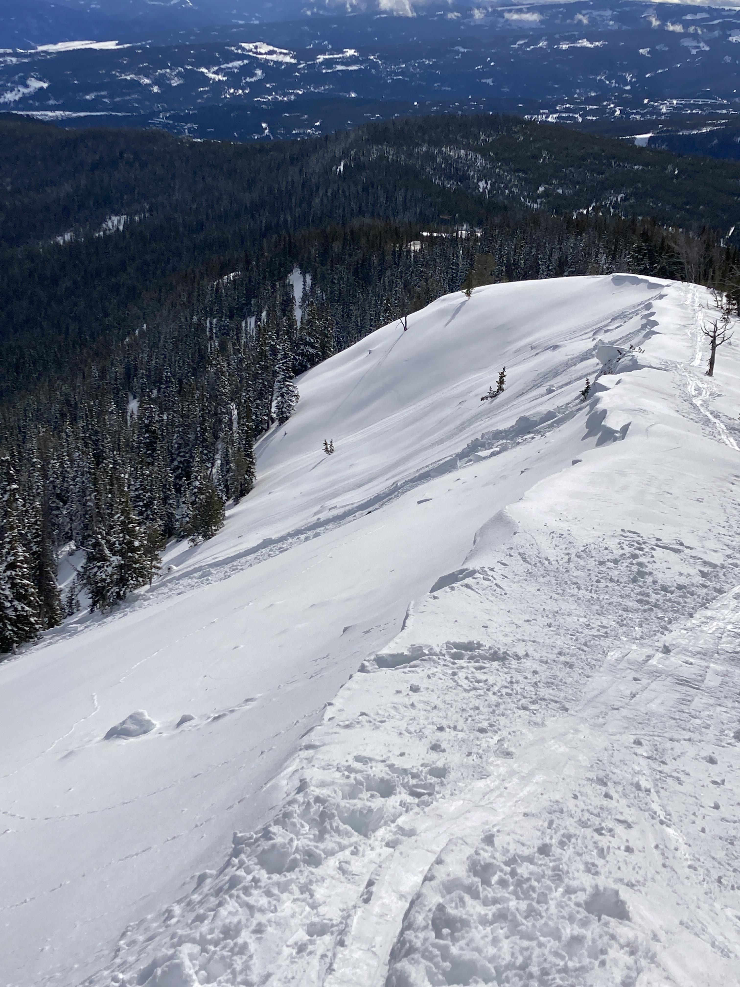
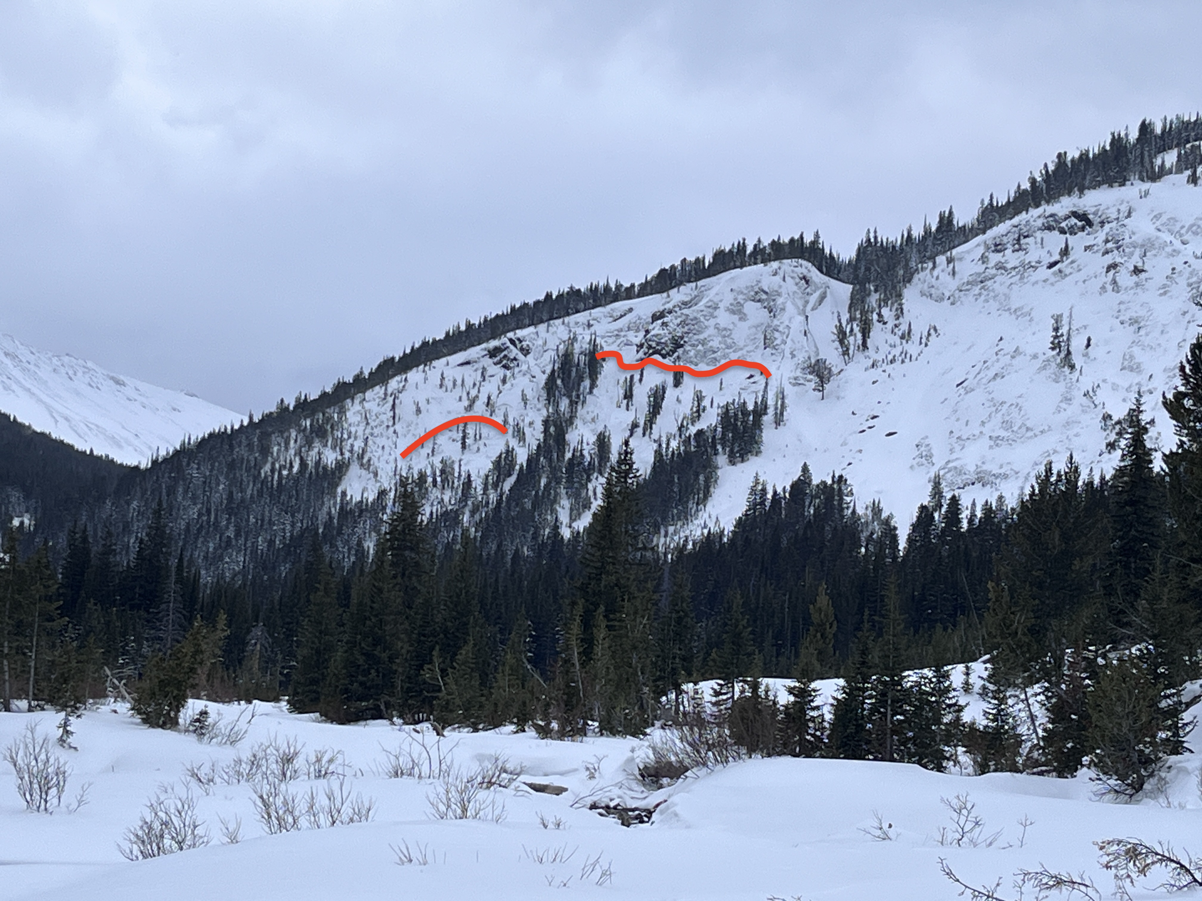
Noted over a dozen avalanches in the last several days around Buck Ridge, the Sphinx and Cedar mtn. Primarily near ridge lines, but also at lower and mid elevations. The most notable slides being the East face of the Sphinx (1/21)and NE basin off of Cedar. Photo of cedar crown.
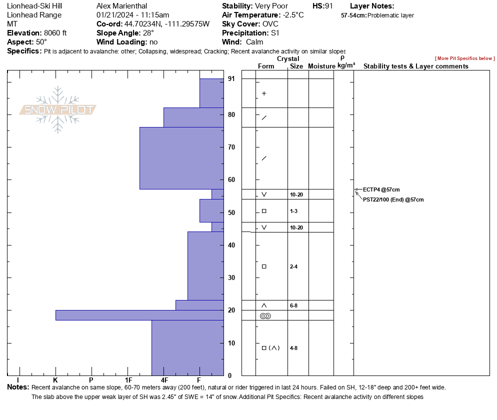
Full Snow Observation ReportThere was low visibility at Lionhead with a thick fog engulfing the ridge. We rode to Ski Hill and dug a pit on the south end. As we approached our pit site we noticed a recent avalanche on the steep center section of ski hill. It looked natural, possibly rider triggered in the last 24 hours, 14-18" deep, 225' wide, 200' vertical. SS-R2-D2-O.
Our snowpit had a layer of well-preserved 10-20mm surface hoar below 14" of snow (measured 2.45" SWE in 14" slab). Below that was soft facets, another layer of surface hoar, and more soft facets. We got ECTP4, and PST22/100end on the upper layer of surface hoar. The nearby avalanche probably failed on that surface hoar layer.
We went to look a little closer at the avalanche from a low angle (25 degree) slope above. While approaching we had a large collapse and shooting crack.
A group of riders in the parking lot saw a similar depth recent avalanche a little further up the ridge.
The snowpack is very unstable and avalanches large enough to bury or injure a person are likely to be triggered on any steep slope.
It was snowing lightly all day with calm wind and overcast to foggy skies.
Full Snow Observation ReportButtermilk was doable, but we got a little stuck trying to squeeze in...
Toured out the gate of Bridger Bowl north of Texas meadows. Walking up through the flat meadow we got 10 or so small whumphs and 3 large booming collapses. No remote triggers on the steep terrain above were observed. Snowpit from where the large collapses were triggered is attached.
Full Snow Observation ReportWe toured up the ridge between Beehive and Bear Basin today. There was about 2-3 cm of fresh snow capping a breakable melt-freeze crust from yesterday. The crust was present on nearly every aspect and slope angle we traveled on (W-S-E). I suspect on steeper east aspects, which we did not tour on, this crust may not have been present.
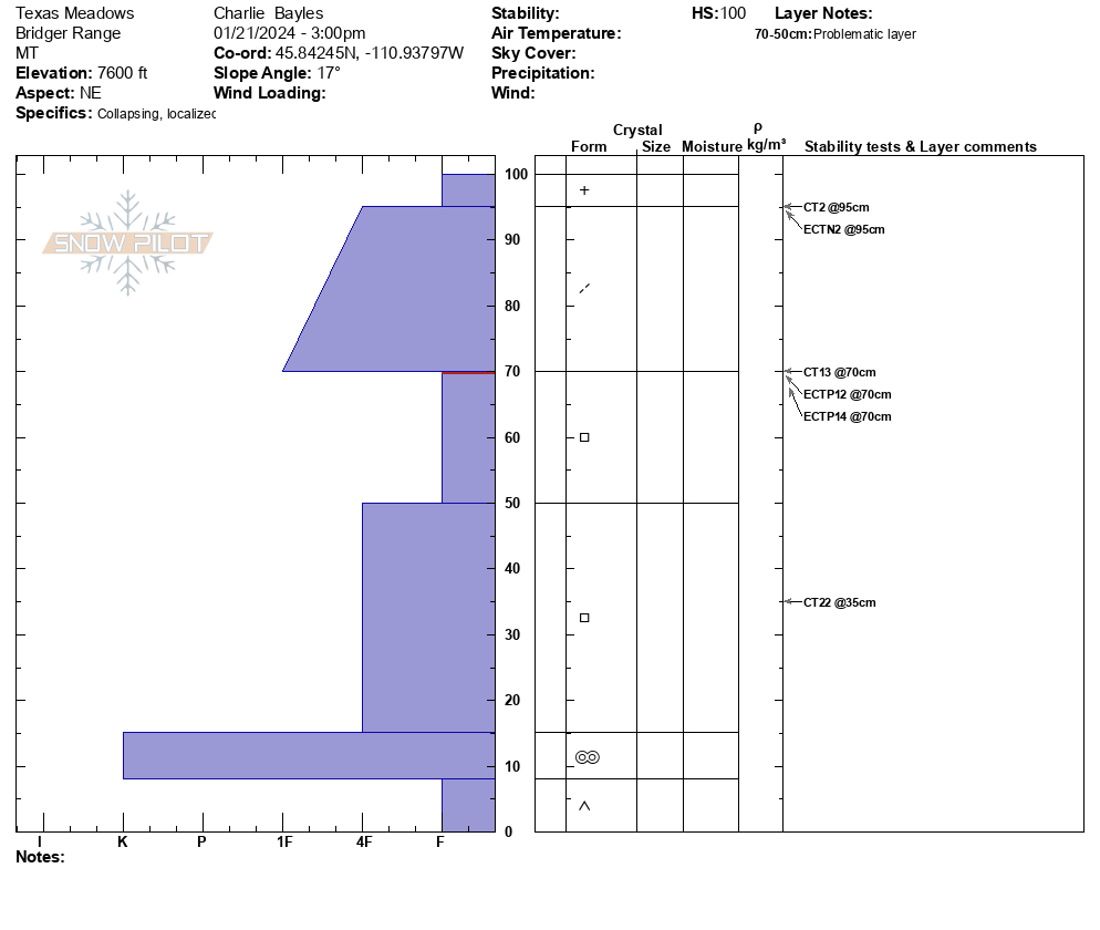
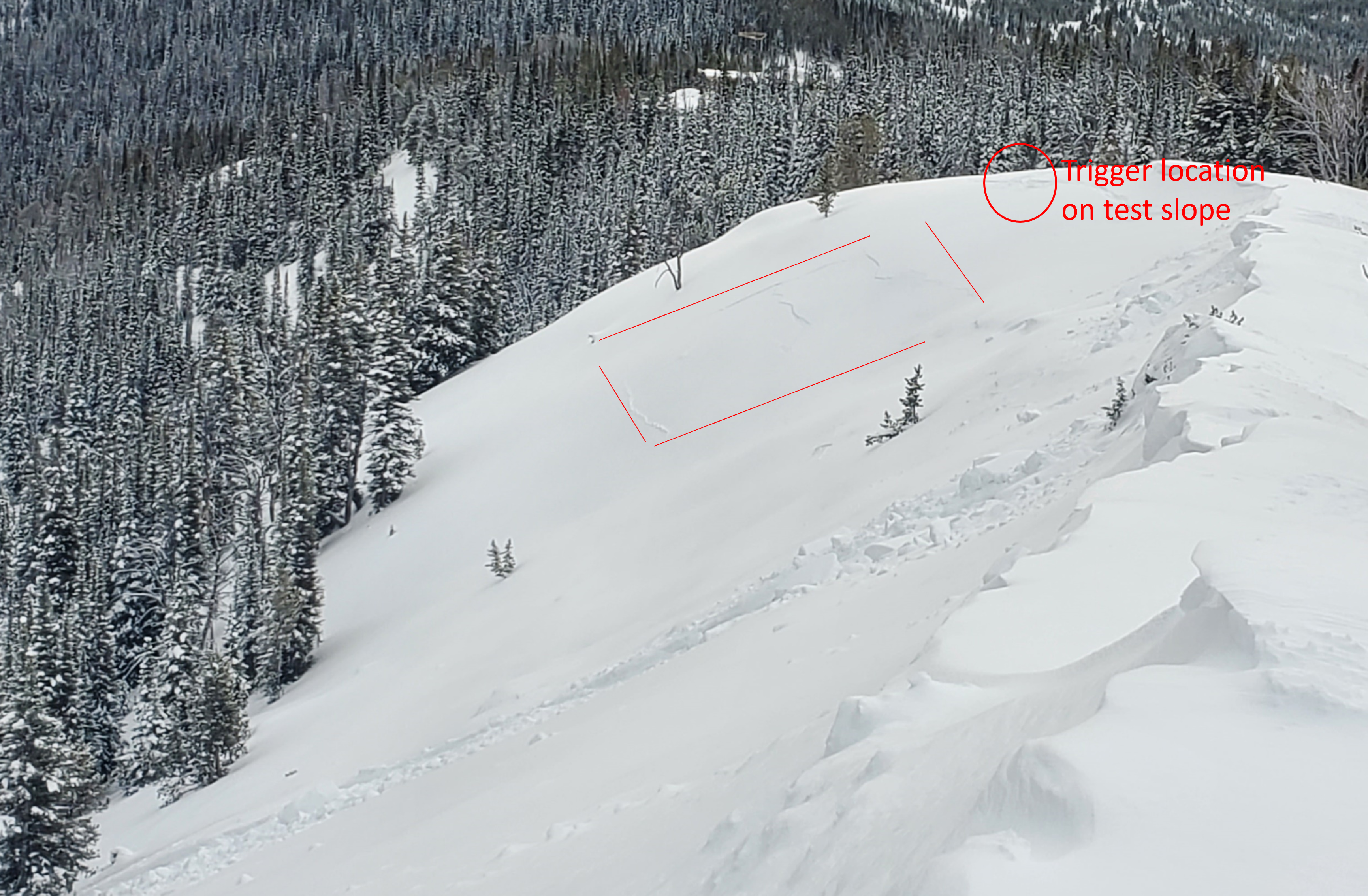
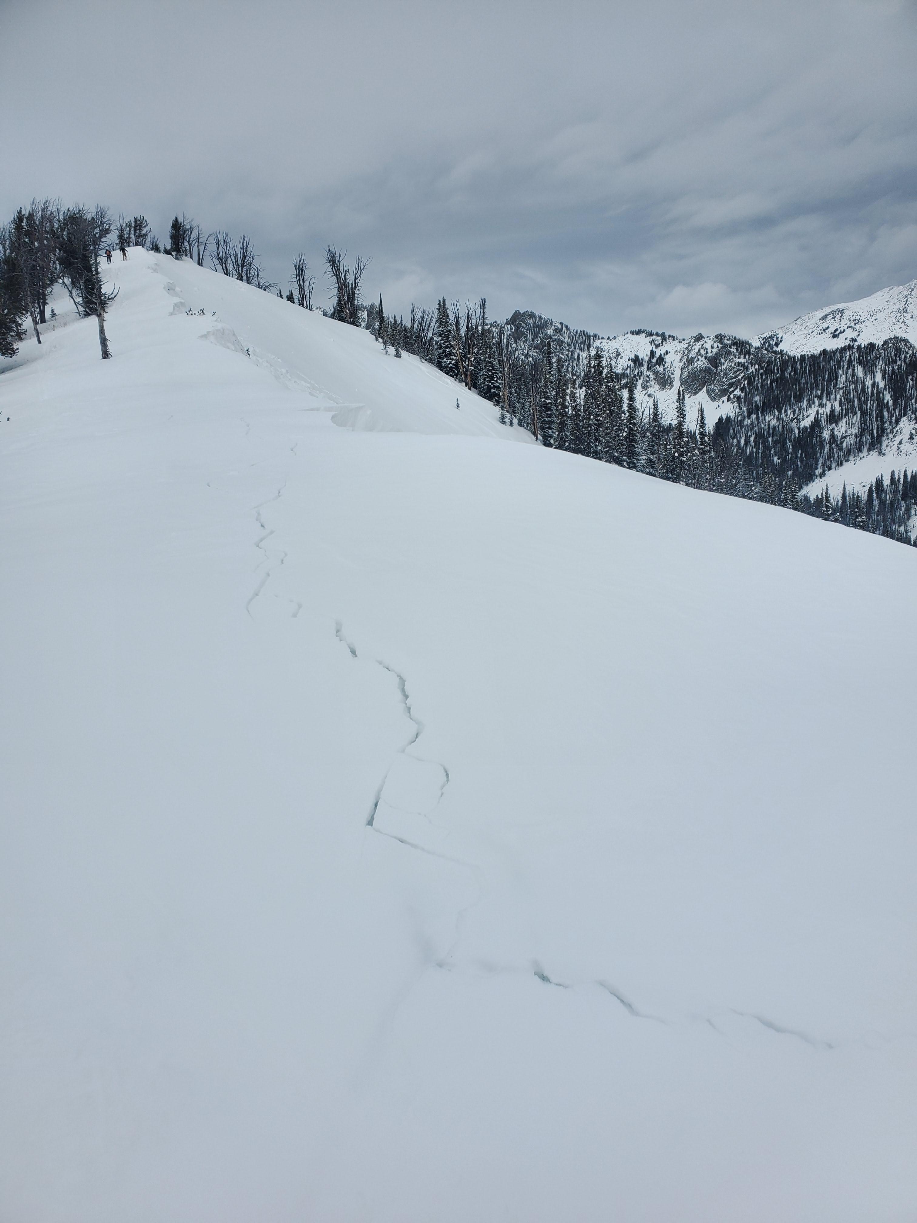
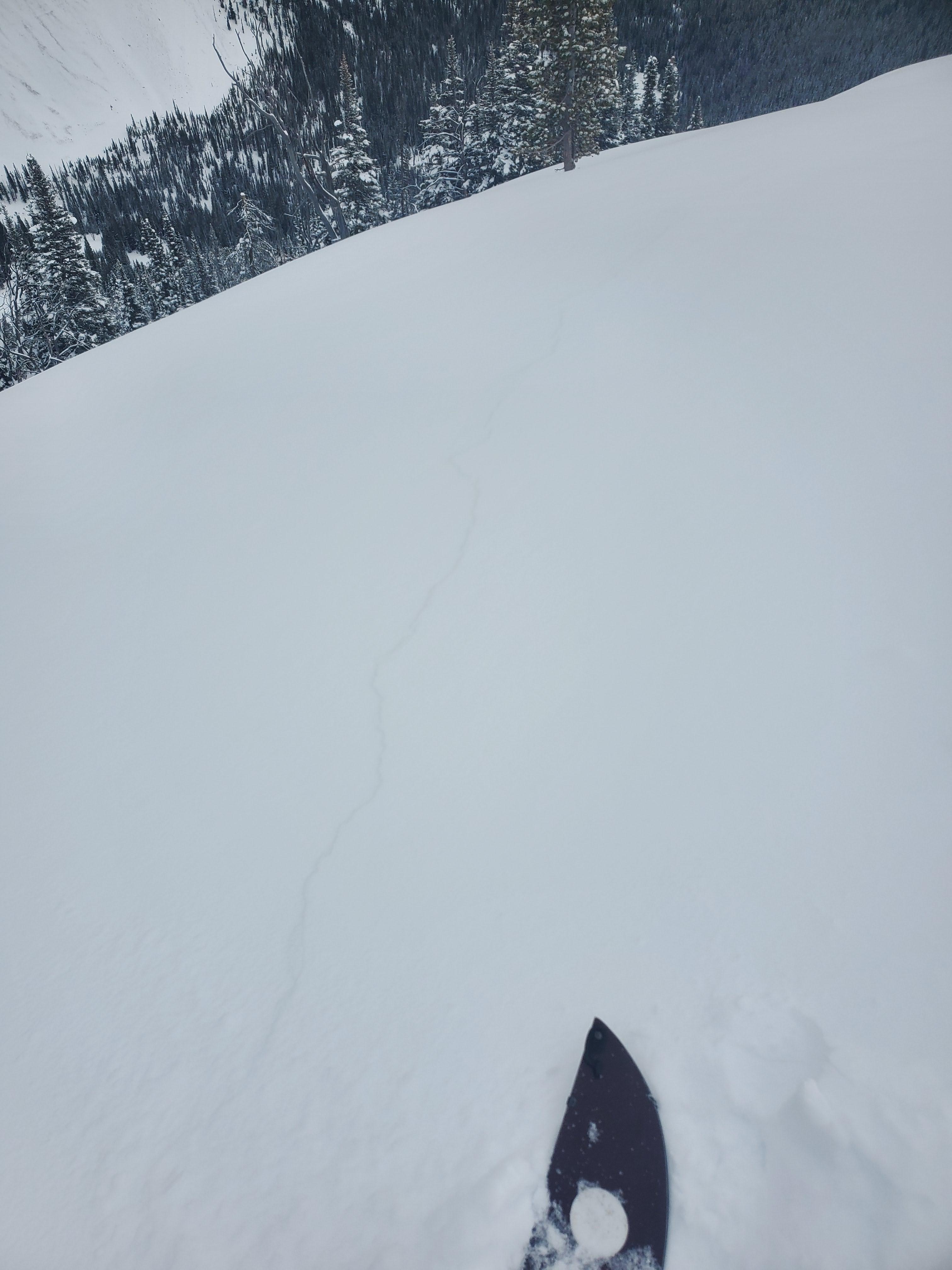
As we approached the cornice-triggered slide from yesterday below the prayer flags, we stomped around on a low-angle east-facing test slope just south of the slide to assess the presence and character of the slab. Stomping on the test slope yielded 15' plus shooting cracks from my ski tips and remotely triggered cracks about 30' further down the slope below a rollover. A subsequent test slope north of yesterday's slide produced a whumpf. A significant chunk of that cornice is cracked and ready to collapse. While jumping on the test slope almost 100 feet away from the cornice, a small piece broke off and fell onto the slope below.
HS on the test slope was about 70 cm. Below yesterday's crust was about a 15-20 cm 4F to 1F slab overlying a pile of facets. The failure plane was at the facet/slab interface and the slab has stiffened since my last time at Beehive a week ago.
Wx: Calm winds, warm temps, broken skies giving way to scattered skies in the pm. No precip.
Full Snow Observation Report1 foot slab on 18 inches of sugar facet.
Full Snow Observation ReportRemote triggered a D1 avalanche from about 150’ away from below in a meadow. Cracking and collapsing everywhere.
Full Snow Observation ReportRemote triggerd a D1 Avalanche from about 150' away. Crown was 1-2' deep. The debris ran onto an apron that was shared with a larger slope which subsequently triggered a larger D2 Avalanche that was about 100' wide with a 3'-4' crown. Lots of cracking and collapsing of the snow pack all day and remote triggered a few other smaller slopes during the day. The snowpack is very sensitive out there right now.
Full Snow Observation ReportEarly season quick obs..........in late January.
Pioneer Mountains have about 60 cms of snow at 8,500 feet consistent with Mule Creek Snotel obs.
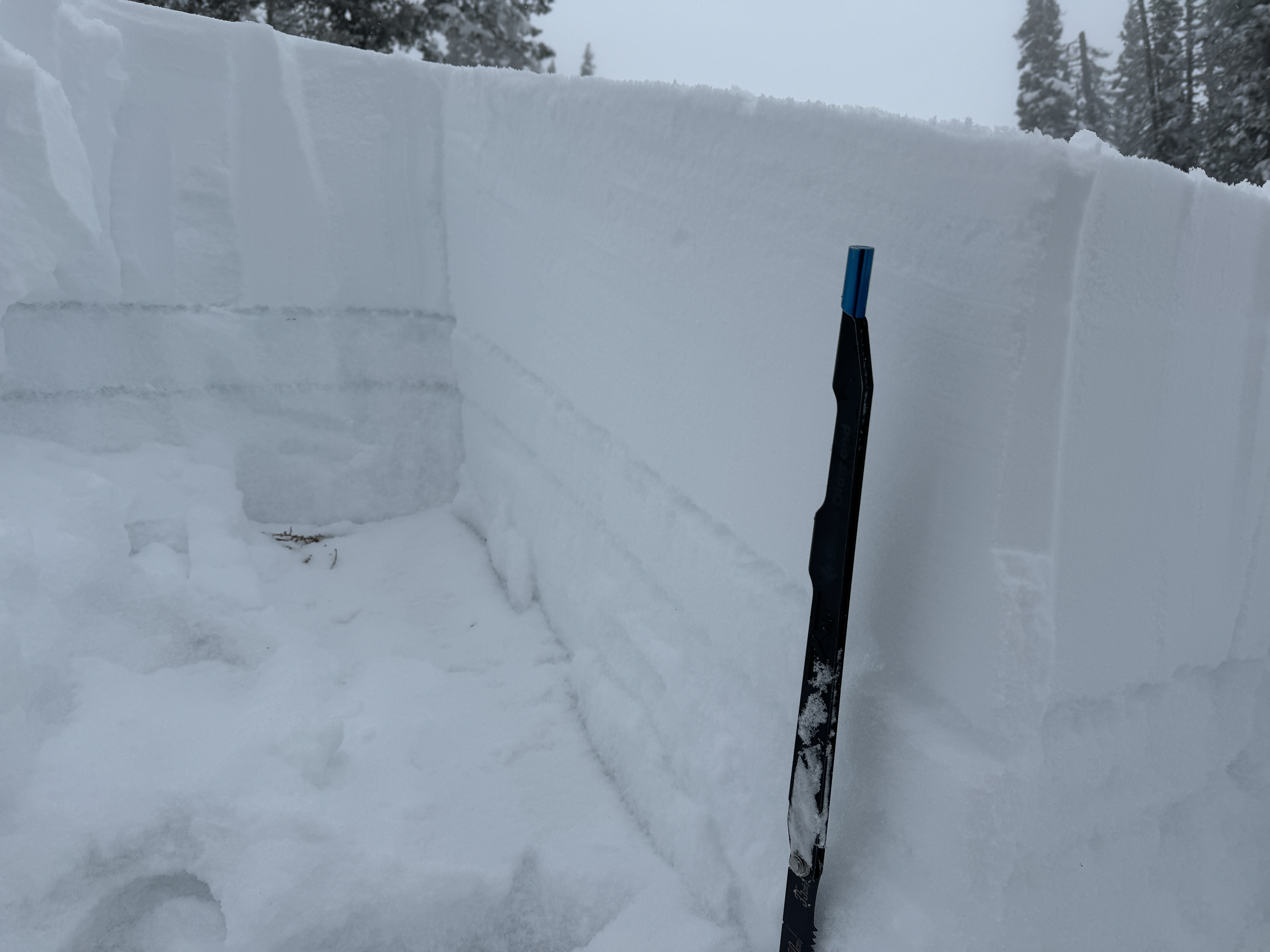
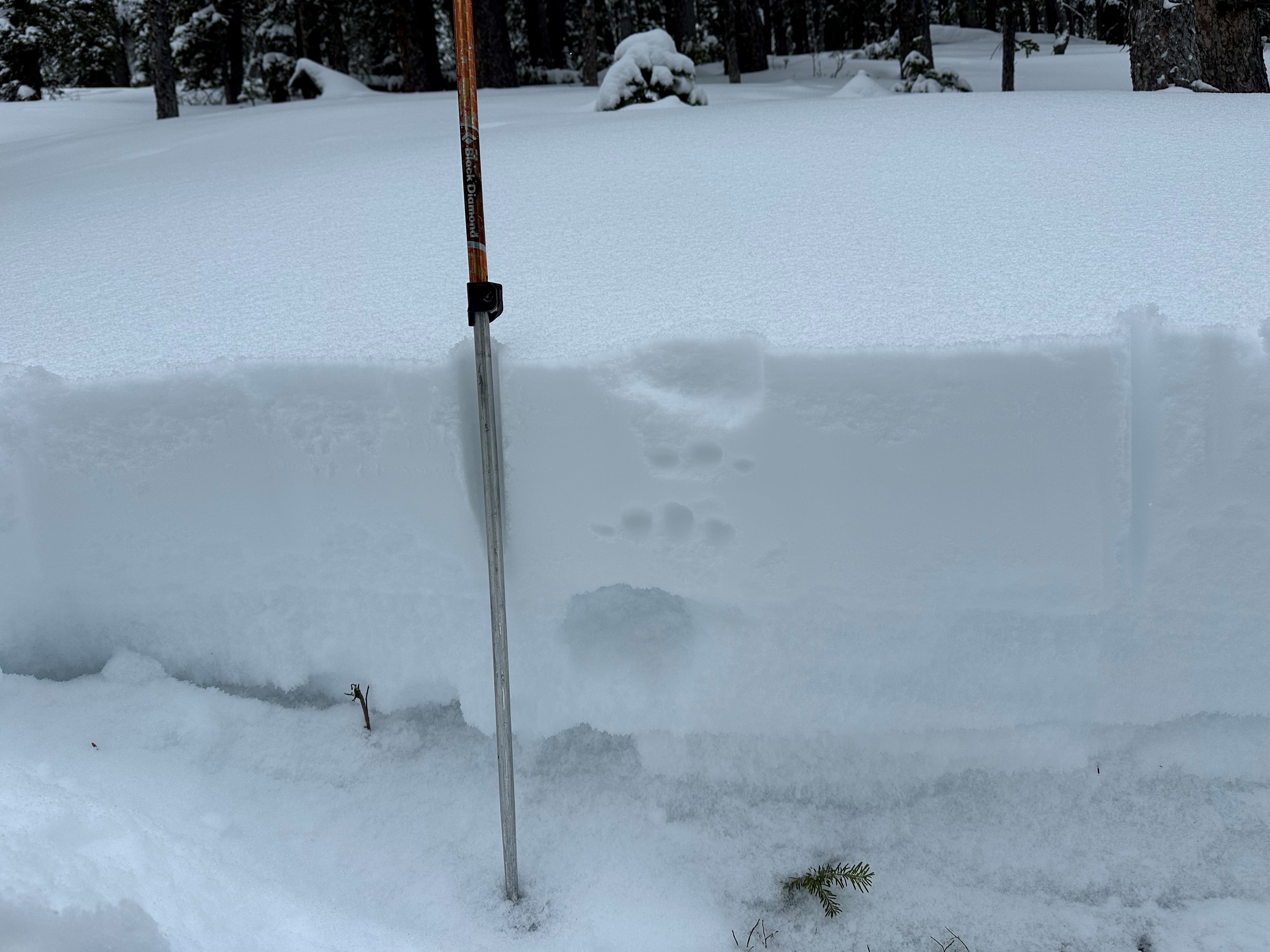
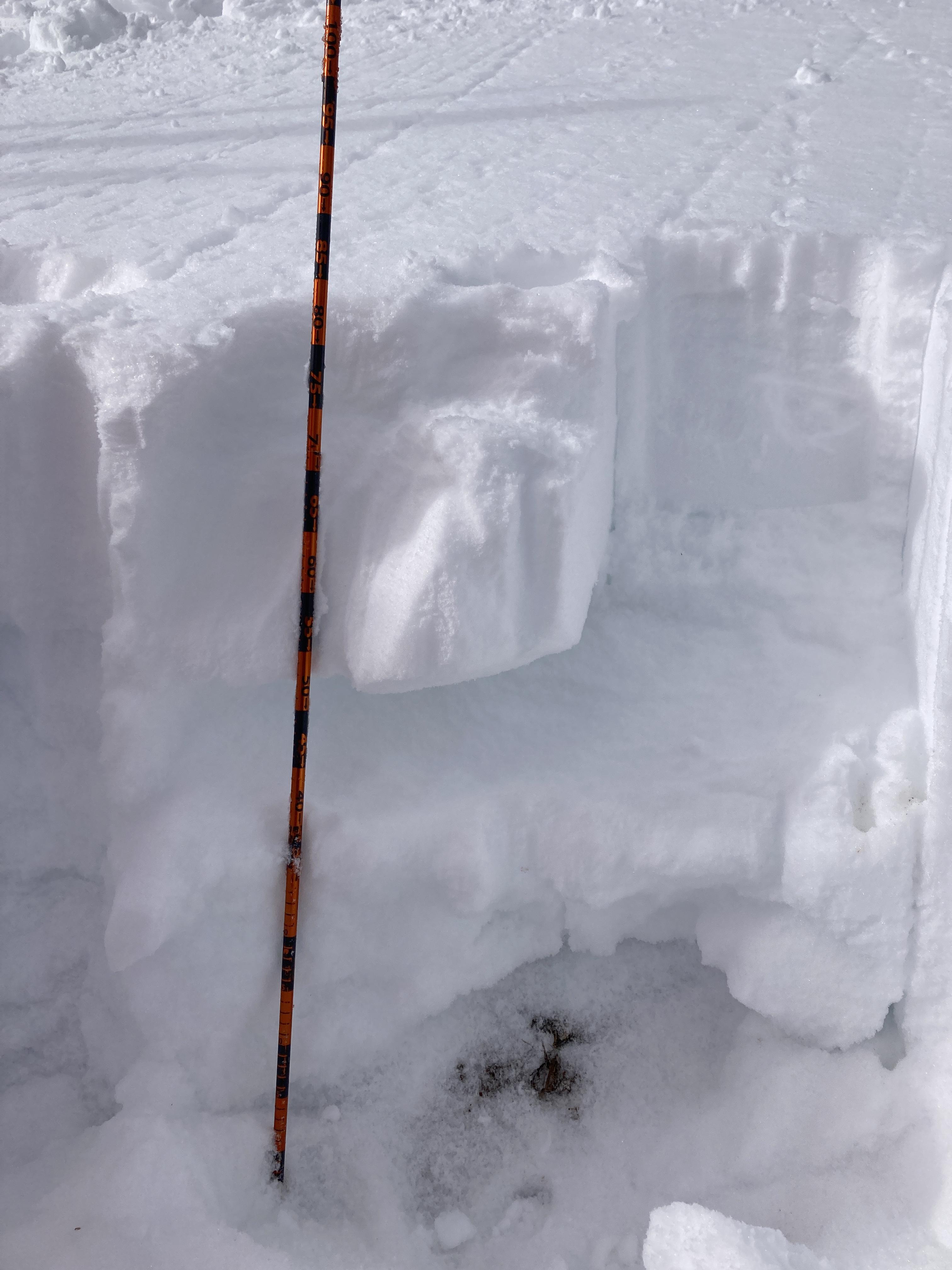
Structure is, not suprisingly, very poor, see photo. 30 cms of Fist to 4F newer snow from last 2 weeks sits on top of 2 layers of faceted snow (3mm - 5mm). Lacks a slab in many places but anywhere wind or sun have firmed up the top layer there is cracking and collapsing as seen in the photo.
Reports of the roadcuts on Pioneer Scenic Byway slid natural this past weekend. Common indicator slopes.
Full Snow Observation ReportFrom BBSP:
They noted 2 or 3 natural slides that occurred last night on the backside of Bridger Bowl in Truman Gulch.
Full Snow Observation ReportGraham mentioned this to me when I was talking to him about the Saddle Peak slide.
From GCSAR and Bridger Bowl Ski Patrol:
A skier triggered a slide descending the skyline/nose of Saddle Peak. No one was caught. It initially triggered at the first rock band, then pulled out much wider at the second rock band. The skier was on his second lap was the third set of tracks on the peak. All tracks were accounted for and a beacon search of the debris came up empty.
Depth was described as "full depth" (2-3') and running on the depth hoar.
Crown was 80' wide on the first horizontal band and 500+' on the second. The lower crown wrappped around the ridge out of view.
Full Snow Observation ReportPete M and Jason H went out there. I talked to Pete and Graham (dispatch).
Quick skin up to the top of the far south Telemark Meadows point. Lots of thumping in the flat untracked areas up the the top. Cracks not easily seen as dense snow covered them as they spread. Quick Pit, 45cm depth. About 4" of new heavy snow on top of yesterdays sun drenched layer. Below lots of loose facets and 2 distinct frozen layers buried 15-20cm below surface to the ground. 0.3" SWE last night. 24 degree slope, south facing. Air and Snow 30F.
Full Snow Observation ReportMy partner and I remotely triggered a persistent slide on an East facing slope at 9350ft. The slide ran off the Evil Twin ridge, just below the large main summer trail bowl of Hyalite Peak. My partner and I were spaced out ~50ft when we both felt and heard a large whumpf. We looked up and saw the avalanche slide, but were both out of harms way from the path. The starting zone was ~400ft above us and the slide ran ~500ft in total length. The crown was just over 2ft deep at its max and 150ft+ wide. The were signs of recent wind loading as we approached the bowl prior to the slide. We did not observe any other avalanches while we were out. Got a couple nice turns in the approach meadows on our way out.
Full Snow Observation ReportSkied beehive basin and dropped into bear basin early this morning before the warm up, about 1-2" of fresh. In a early morning pit on the bear basin side near the top of the ridge we didn't get propagation but got cracking on hit 5 of our ECT. Noted a slab over facets buried ~ 50 cm from the bottom, with another slab and facet combo below that to the ground. ~90 cm total depth. As it warmed up other groups reported collapsing as they came up and we also saw the aftermath of a remotely collapsed cornice.
Full Snow Observation ReportI toured in beehive today around the wilderness boundary and summer trail, riding and digging a pit on the E aspect (left side)as I was skinning toward the lake. There was about 90cm where I chose to do my profile. Got CT 2 SC Q2 shear 70 cm down. I got ectp11 at 30 cm down. Talked to a seperate group of 2 splitboarders that came up skinning behind me, they had just dug a pit probably 50 ft below me, they also got ectp11. I saw a skier triggered slide on Tyler’s hill (lookers right of prayer flags gully), as I skinned in (ss-as-d1.5-r1-u). It looked like it propagated across about 25 ft and just pulled out on the single roll over, I didn’t get real close, and figured a picture from that distance with trees in the way might not show much. Had skin glopping going on, most aspects on my split ski out had a crust on them, but that’s lower elevation.
Full Snow Observation ReportWidespread cracking and collapsing were observed both north and south of Cooke City.
North of Cooke City Level 1 snowpits:
Got multiple ECTPs 12-17 taps, 65 down. Got one ECTV. HS ranging from 110-165.
9820' SW, Aspect, ECTP16 60cm down on small grain faucets
South of Cooke City Level 1 snowpits:
Dug a total of 7 pits throughout the day and 5 got propogation <5. Failing on the same SH/Facet layer 30-45 down
South of Cooke City numerous avalanches were observed on E, W, and Northern aspects. These all likely happened during or following a recent storm on 01/18. We stepped off the skin track and remotely triggered a small slope above the creek below. Took a closer look and it failed on surface hoar/facets 35 cm down. A skier-triggered avalanche was also seen on the west side of Woody Ridge.
Full Snow Observation ReportNaturals on most slopes, small in size for the most part. Poor lighting but the terrain near the climax also went.
Other emails from BPG:
Nina: Wow, nice! The last time that slope was remote triggered was in Feb 2017 at the beginning of the historic avalanche cycle. Forrest dug a pit a few steps below the skin track and remote triggered that slope.
Gloria: yah Zack was pumped he kept saying, I triggered Forrest's Avalanche!
Ski toured to west Woody Ridge today, south of Cooke City.
We set a new skin track and I would estimate that 80%+ of the snow we touched created a large collapse/ whompf. Many of the collapses were large and loud (over 100' wide). It seemed like remotely triggering an avalanche would have been easy/ likely had we been connected to steeper slopes.
We noted widespread avalanche activity in a nearby gully (NW aspects) adjacent ski tracks from yesterday.
In our snowpit at 9700', on a westerly aspect, we had an ECTPV. On 2mm facets, 45cms down.
I've skied that area a lot over the last 15 years, commonly during big snowstorms and elevated avalanche hazard, but today seemed like one of the most hazardous, if not THe most hazardous days for avalanches I experienced there- given the widespread nature of the PWL and thickness and sensitivity of the slab.
The warm temperatures today likely had a significant influence on the instabilities. (35 deg F in town for much of the afternoon.) Lots of roof-a-lanches noted today as well.
Full Snow Observation ReportFrom BSSP 1/20/24: "There were large avalanches observed on Cedar Mountain, on northerly aspects. Slides appeared to
be running on basal instabilities deep in the pack."
From email on 01/22:
"On 1/20, we toured north of town into sheep creek to ski the north-facing burn glade. We saw no new avalanche activity, but continued to experience numerous collapses as soon as we stepped off the skin track. The sun came out periodically in the morning, and that's all it took for the new snow to become much more wet and heavy. The denser snow was able to support the weight of a skier a little better and we subsequently experienced fewer collapses. Winds picked up from the west into the afternoon and began to transport a lot of snow around."
Full Snow Observation Report
