Good Morning. This is Doug Chabot with the Gallatin National Forest Avalanche Advisory issued on Tuesday, January 30th at 7:00 a.m. Today’s advisory is sponsored by MAP Brewing in cooperation with the Friends of the Avalanche Center. This advisory does not apply to operating ski areas.
Last night an inch of snow fell in the mountains near Cooke City and West Yellowstone. Under cloudy skies winds are out of the southwest at 40 mph with gusts near 70 mph at the ridgelines. Mountain temperatures are in the 20s and this morning a strong frontal passage brings snow in the mountains and possibly rain in the valleys. By this evening 1-2” will blanket the mountains with Cooke City getting 4”.
On Sunday, outside Cooke City, skiers triggered two small avalanches (photo, photo), and yesterday another small slide was triggered on a wind-loaded slope (40’ wide; 12-18” deep). Around Lionhead the snowpack remains weaker than other areas from sugary snow near the ground, but it is getting more difficult to trigger avalanches with each passing day. I saw this twice in the last week, once in Lionhead (video), and again this Sunday in Cabin Creek in the southern Madison Range (video). In general, our snowpack in the southern mountains is strengthening.
Wind speeds are 20-40 mph out of the southwest and a few slopes will be wind-loaded. Wind slabs are not widespread, but skiers triggered a small one yesterday and another skier saw a 3’ deep avalanche on a north-facing slope up Republic Creek in Cooke City. For today, human triggered avalanches are possible and the danger is rated MODERATE on all slopes.
The mountains near Bozeman and Big Sky are mostly stable. Alex was in the Bridger Range on Saturday and found the new snow was bonded and winds were not forming drifts. In the last two days, strong wind scoured many slopes and reports from ski patrols indicate there is not much loose snow left to blow around. Field observations from the northern Gallatin and northern Madison Ranges all indicate good snow stability. If you went out of you way looking for trouble you might find a small wind pillow near the ridgeline that could avalanche, but in general, avalanches are unlikely and the danger is rated LOW.
If you get out and have any avalanche or snowpack observations to share, drop a line via our website, email (mtavalanche@gmail.com), phone (406-587-6984), or Instagram (#gnfacobs).
King and Queen of the Ridge
King and Queen of the Ridge, Saturday, February 3rd. A Hike and Ski/Ride-a-Thon fundraising event to support the Friends of the Gallatin National Forest Avalanche Center. Sign up and start collecting pledges HERE.
Upcoming Avalanche Education and Events
BOZEMAN
Feb. 6th, Sidecountry specific avalanche awareness for family and friends. 6-8 p.m. @ Beall Park
Feb. 7th, Woman’s specific avalanche awareness, 6-7:30 p.m. @ REI in Bozeman
Feb. 7th, Avalanche awareness, 6-7:00 p.m. @ Roskie Hall MSU
Feb. 9 and 10, Companion Rescue Clinic, Info and Register
March 2nd, Avalanche Awareness, 6-7:00 p.m. Bozeman Split Fest
March 7th, Avalanche Awareness, 6-7:30 p.m. @ REI
PHILLIPSBURG
Feb. 8th, Avalanche Awareness, 6:30-8:30 p.m. @ the new Fire Hall
DILLON
Feb. 24th and 25th, Snowmobile intro to avalanches w/ field course. More info: https://msuextension.org/conference/.
WEST YELLOWSTONE
Feb. 3rd, Avalanche Awareness, 7-8 p.m. at West Yellowstone Holiday Inn Conference Center
Feb. 10th, Avalanche Awareness, 7-8 p.m. at West Yellowstone Holiday Inn Conference Center
COOKE CITY
Every Friday and Saturday, Current Conditions Update and Avalanche Rescue, Friday 6:30-7:30 p.m. at The Soda Butte Lodge in February. Saturday anytime between 10-2 @ Round Lake.
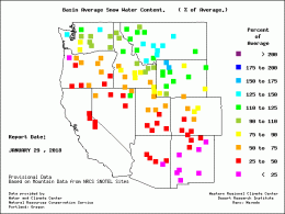
Check out this photo. It feels good to be living in the powder "Haves" vs. "Have not" group. Look at the blue squares clustered in southwest Montana. We have over 125% of average snow water content and Cooke City has over 150%! Whoop, whoop.


